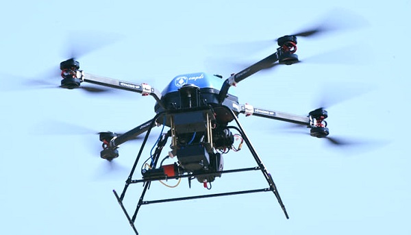
CMPDI will now monitor CIL mines by drones

New Delhi: CMPDI will use drones in CIL mines for specialized survey applications in coal mines of CIL such as generation of high-resolution images, 3D terrain mapping, volumetric measurement of excavation, etc
The Ministry of Civil Aviation, Govt. of India has accorded conditional exemption to Central Mine Planning & Design Institute (CMPDI) the use of drones for surveying coalfield areas of Coal India Ltd. for acquiring data for monitoring of various activities.
CMPDI will use drones in CIL mines for specialized survey applications in coal mines of CIL such as generation of high-resolution images, 3D terrain mapping, volumetric measurement of excavation, etc. and mapping of areas for precise delineation of zones where underground mine fires are present. There are several applications where these drones can be used such as inspection of installations and components in inaccessible and difficult-to-reach areas for safety of men and machinery, blasting zone monitoring, etc.
Read Also : REC Ltd's arm hands over SPV of HVDC Transmission Project to Power Grid CorporationNews Must Read
- DMRC, NCRTC Launches Integrated QR-Ticketing System Enabling Seamless Travel
- K Sanjay Murthy appointed new Comptroller and Auditor General of India
- NHPC Director Reviews Progress of 2000 MW Subansiri Lower HE Project
- DRDO conducts flight test of first long range hypersonic missile off the coast of Odisha
- Defense PSU stock, Bharat Dynamics shares down by 45%, What to expect now
- CMD inaugurates BPCL's 1st LNG Fueling Station
- DVC Signs Power Purchase Agreements with GUVNL
- JGU and IIT Madras to Develop High-Tech Robot Guide for Constitution Museum
- BPCL Shines at 18th Global Communication Conclave, Wins Multiple Awards
- EIL Achieves Milestone: 5 Catofin Reactors Erected at GAIL USAR PDH-PP